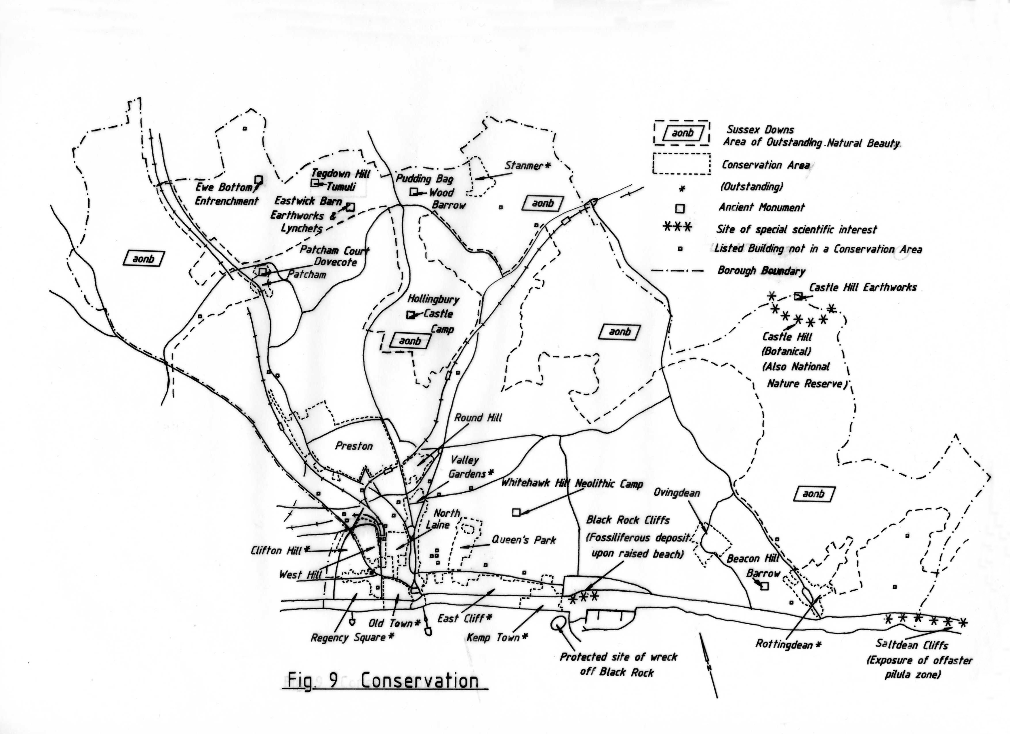
Please note that this map is an extract from a reference work written in 1990. As a result, some of the content may not reflect recent research, changes and events.
Click here for a full-sized version of the map
Please read our Terms and Conditions in regard to usage of this image


Comments about this page
This area of the website provides insufficient information about the boundaries of conservation areas that represent the entirety of the City Council in its current state.
Sadly the only graphic available, which dubiously enough is a hand-drawn map, dates back from 1990 and the supposed full-sized version of the image has a dead link. Looks like this page, and quite possibly this entire section of the planning documentation relating to conservation areas have not been updated in a while!
It would be helpful to at least have a citation of the map’s origin, so that the people who undoubtedly visit these pages
Add a comment about this page